That was certainly a tough one, but it was well worth it.
I’ve been toying around with the idea of a double century in Las Vegas for a while. I’ve even floated the idea of a “Southern Nevada DC Challenge” and created a few routes to support such an enterprise. It wasn’t until researching historical double centuries on the California Triple Crown web-site that I found a truly promising route.
While browsing the California Triple Crown page I found a historical list of double centuries which are no longer active. Digging deeper, more and more routes came to light that I wanted to save for future reference. Ultimately I ended up with a collection of 31 official double century routes. One of these was an out-and-back route by Mountain High Cycling’s Las Vegas Double Century which, as far as I can tell, was last run in 2007. Going over the route there were a couple changes I felt were needed.
First, the course started by routing riders over to the RMT near Ithaca. Riders would remain on the RMT until the River Mountains Loop trailhead off Lake Mead Pkwy. A similar routing was used for the return. This would ask riders to navigate the Three Sisters both forward and back in the dark. I’ve known cyclists to have difficulty with that stretch even in optimal conditions, so asking a rider to do so in the early morning or evening light seemed like a recipe for disaster.
Second, the course was short at only 186 miles. If I was going to plan a double it was going to be at least 200 miles. Not 190, not 195, but at a minimum 200. Playing around with RideWithGPS I was able to hit the mark by adding trips down-and-back to both Callville Bay and Echo Bay and a loop near Lake Las Vegas near the end. This loop would have the added benefit of avoiding a potentially dangerous left turn from Lake Mead onto Athens.
With the route set it was time to figure out when and if it would happen.
During one of our Tuesday night post-ride dinners I was chatting with Robert about various DCs, the research I’d done, and shared this updated idea for a Las Vegas Double. My previous Las Vegas DC idea entailed looping around Mt. Charleston via Parhump and back, but the return section of US-95 put everyone off. This new route, however, sparked a huge interest in Robert, and he said that we should do it on the Saturday of Super Bowl weekend. With the date settled, Robert would go about finding some sag support, and I would share the ride on the group’s Facebook page and the Las Vegas Group Rides Strava group page.
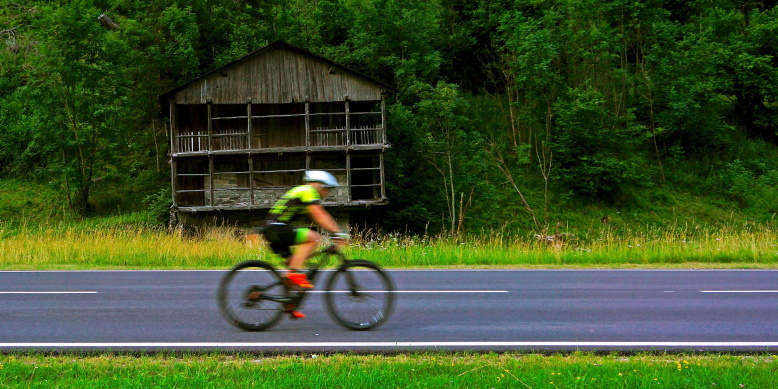
Come the day of the ride we had a very solid group of ten riders, including myself, who would be attending. This included a friend of the club’s, Roehl, from Fresno who would be riding a tandem with Jennifer. Sag support would come from our Super Sag Tony and first timer Matt. The early bird group, which started at 4:00 a.m., consisted of Robert, Roehl, Jennifer, and Chanel. The late group, which started around 5:00 a.m., was Kant, Stuart, Caleb, Boots, Dave, and I. In addition, Dennis and his friend Larry were joining in with our group with the intention of “only” doing a century.
Our group couldn’t have really asked for a better day, weather wise, to ride a double century. The day started chilly, warmed up nicely through the afternoon, and cooled again once the sun went down. I went with my typical cold weather kit for the morning, dumped the arm and leg warmers at lunch in Overton, and then added them back on at the Northshore Summit stop. Thankfully with our sag crew we didn’t have to worry about lugging around this extra kit with us.
I was pleasantly surprised at how great the route was. We had a mix of full sag stops and check in points all along the way. The check points were there as a “just in case” point, while the full sag stops would break out all the supplies. The check points were at Callville Bay, Echo Bay, White Domes, Rogers Spring, and Terrible Herbest at Olsen and Lake Mead Pkwy. The full sag stops were at Redstone, the McDonald’s in Overton, the Moapa Paiute Travel Plaza, and Northshore Summit Trailhead. I think the stops were placed perfectly.
The highlight of my ride was seeing two wild horses on the east side of Northshore Road just before the Echo Bay turn off. The two of them were just hanging out enjoying the morning sun as we rode on by. A close second for the highlight of the day was the sunrise we caught as we stopped at Callville Bay.
The low point came at Rogers Spring. As our group of four, Dave, Boots, Kant, and I, hung out and refilled bottles, Dave came up alongside me and asked, “Hey Elvis have you noticed that bulging tire?” I looked down to see a 1-2 inch log bulge in my rear tire where it appeared either the tire bead had come loose or been completely torn. By some miracle Tony had brought some spare tires so I went to work swapping it out. This would haunt me later because I didn’t get nearly enough of a rest off the bike as I would have liked, but I have a thing about letting other people wrench on my bike. Ultimately, I was able to get Shadow fixed up with the new tire and we were able to ride on to the finish.
Overall, and as mentioned at the start, this was a challenging ride. Reviewing the stats logged by my Garmin, it is on par with the Best of the Bay and Carmel Valley double centuries. All three are just a hair over 200 miles and around 14,000 feet of elevation. I would be so bold as to say this double is more difficult because you are forced to ride.
On BoB and CV, you have some reprieve in the occasional stops for lights or stop signs, with this being especially true with BoB. This Las Vegas double has very little of that. Once you’re within the borders of Lake Mead NRA, your only required stops are before making right turns onto Northshore Road. The same can be said within Valley of Fire when making the right turn after riding out to White Domes. Hell, once you return to Northshore after Valley of Fire you’re looking at a 46 mile long non-stop stretch of road. No mercy lights, no stop signs to save you.
Since finishing this ride, Robert has a fresh desire to host a double along this route. With some of his feedback, we’ve updated the route to make it potentially one of the best double centuries of the California Triple Crown, should they allow it to be included in the “official” series.
The 2026 version, which we’re hoping to make an official event, is updated to start from Railroad Pass, navigate east along the RMT until Hemenway Road where riders will join Lakeshore Road. Riders will remain on Lakeshore until making the turn onto Northshore and ride the current route while removing the two out-and-backs to Callville and Echo Bays. The return is updated to remove the Lake Las Vegas loop, but adds the Burkholder climb to the RMT in order to return to Railroad Pass. Overall, according to RideWithGPS, the route is 203.6 miles with 14,612 feet of elevation.
I like the tagline of “Come for the double, stay for the Super Bowl” with the goal of hosting this on Super Bowl Saturday again. Now the work will begin on making this “official” and everything that it will entail. If that doesn’t happen, I’m almost certain that we, as a small cycling club, will ride this updated route in 2026.
I feel this Inaugural LVAV Double Century was an amazing success. A large amount of credit for our success needs to go out to both Tony and Matt who did a superior job of providing support. Without them this ride wouldn’t have been nearly as enjoyable as it was. With their help, everyone finished, and, other than my tire, we had zero mechanicals. I seriously hope that it becomes, at a minimum, an annual Las Vegas Adobo Velo event, and, hopefully, a member of the California Triple Crown series. It was certainly a great way to kick off the 2025 Double Century season.
New bike fund: $85.75 (+$0.30), €1.52 (+€0.00), ₱10.00 (+₱0.00), ֏10.00 (+֏0.00)
5.49 new miles — From Wandrer.earth
2,710 total shifts, 221 front, 2,489 rear. 53.8% of the ride in the big ring, 46.2% in the small ring. Most time spent in 36×21, 10.7% — by di2stats.com
344 vehicles @ 1.7 per mile, 0.5 per minute, Speeds: 34.0 mph (avg), 64.0 mph (max) — by MyBikeTraffic.com
Partly cloudy-Clear, 50°F-60°F, Feels like 49°F-60°F, Humidity 33%-20%, Wind NNW 4mph-NE 4mph — by Klimat.app
— myWindsock.com Report —
Weather Impact™: 2.5%
Headwind: 39% @ 1.9 – 23 mph
Longest Headwind: 39m 36s
Air Speed: 16.6 mph
Temp: 47-63.6 °F
Precip: 0% @ 0 Inch/hr
— END —
Max elevation: 3028 ft
Min elevation: 1161 ft
Total climbing: 14081 ft
Total descent: -14108 ft
Total time: 14:37:24
[…] 12Total Distance: 927.26 MilesTotal Ride Time: 51:57:56 (H:M:S)Longest Ride: 202.47 miles – Inaugural LVAV Double CenturyCalories Burned: 42,706Total Elevation Gain: 42,247 ftAverage Speed: 17.8 MPHAverage Heart Rate: 137 […]