Area cyclist finds bikepacking nirvana at a state park and the meaning of life on the inside of a Tootsie Pop wrapper. Film at 11.
It was a funny little teaser description put on Strava while I did all the backend work to get everything posted. Wanted to save it here for the future.
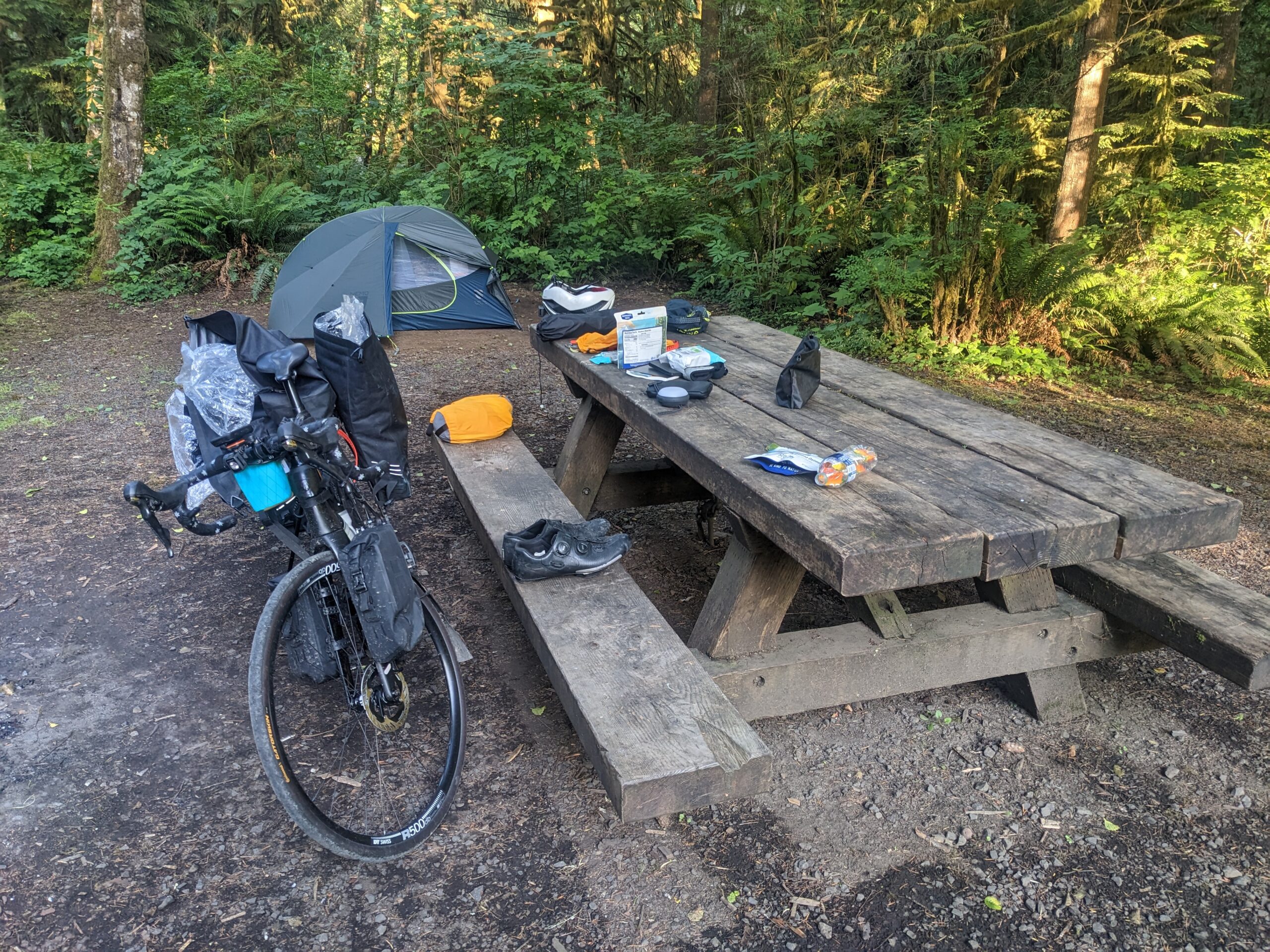
Woke up around 5:30 or so this morning and slowly got moving. Had some breakfast in bed and decided to site and read a chapter from my book since I didn’t get to read at all last night. Of course the chapter would end on a cliffhanger.
I go through and start packing and one of the guys from the site over comes out to his car. He grabbed what he needed then asked where I was coming from and where I’m going. I tell him the story and he’s like “Dang! You need some water for today?”. Now we’re sitting at a campground that doesn’t have running water and at first I thought of saying, “Nah I’m good I’ve got a bottle and half right there.”. Then I got to thinking never turn down a good thing so I say, “Sure I’ll take a couple if it’s not too much trouble.”
He replies, “I work in construction and always carry extra just in case.”
I take one and dump it into one of my bottles and stuff the other in a rear pocket.
Before leaving I walked my site to do a little cleanup. I usually do this at every campsite to leave it as good as, if not better than, I found it. This site needed a little help which isn’t surprising considering it is a primitive campground with no trash recepticles. During my sweep I found three pennies for the new bike fund for my trouble!
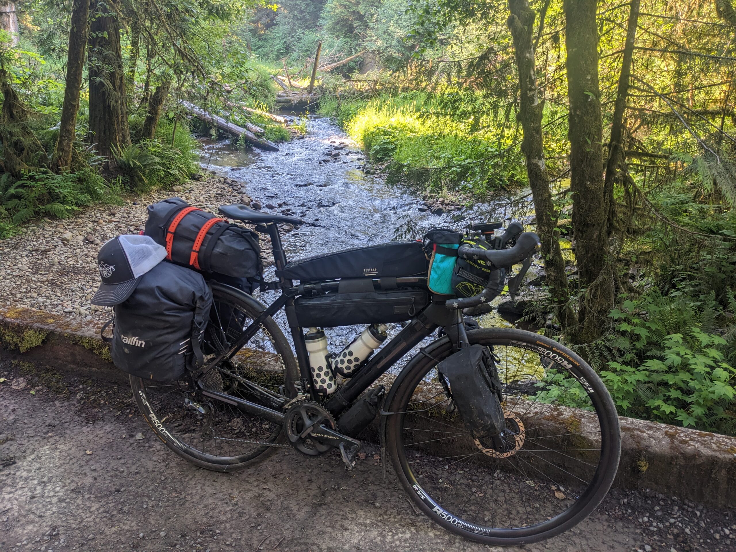
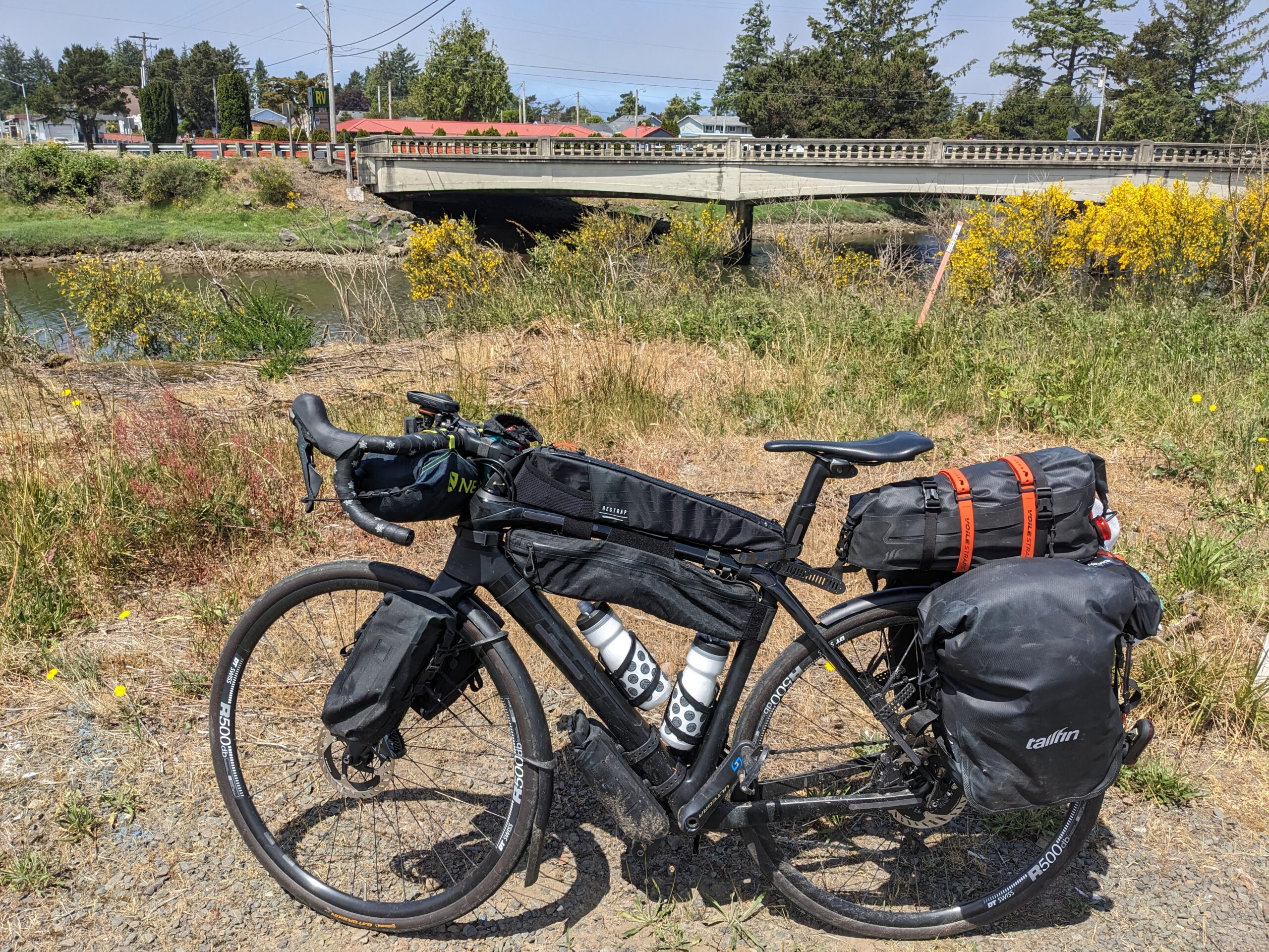
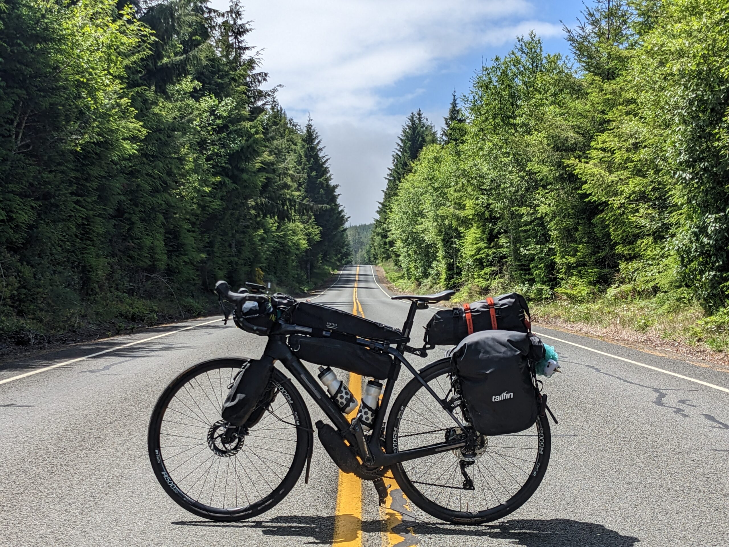
Finally all packed and ready to go I rolled out. I didn’t get but 100 feet before stopping for a quick picture. Little Gnat Creek was looking awesome this morning with the sun filtering down through the trees.
After taking my pictures, I struck up a brief conversation with a couple guys heading up to do some fishing. Just a quick talk about my plans, where I’m going, coming from, etc. Nice pair of guys. I wished them good luck and rolled off.
A short time later I pulled over at a Chevron station to drop off my trash and the trash I’d collected at camp. As I was leaving I spotted a nickel in the road and snapped it up. Seems like doing a good deed paid off twice today!
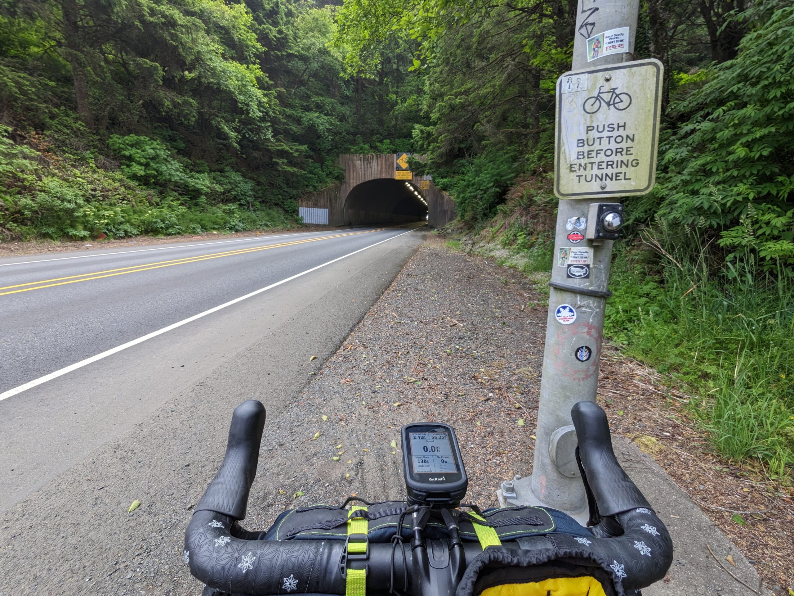
It was about this time I started to wonder when my planned turn was going to come up. The map had indicated a right turn not too long after leaving camp and I should have hit it by this point. I pulled up the map only to realize I’d missed it! Looking back I probably shaved ten or more miles off today’s ride, and I can only speculate that the ACA routes you that way to avoid a stretch of US-30. I didn’t have much issue with it so it’s hard to understand the reasoning.
As I started rolling into Astoria I again realized my computer was routing me incorrectly. I pulled up the map on the Garmin Connect App and I was still on the highway when I should have diverted onto a trail. I stopped and restarted the course and that resolved any weird routing issues for the remainder of the day.
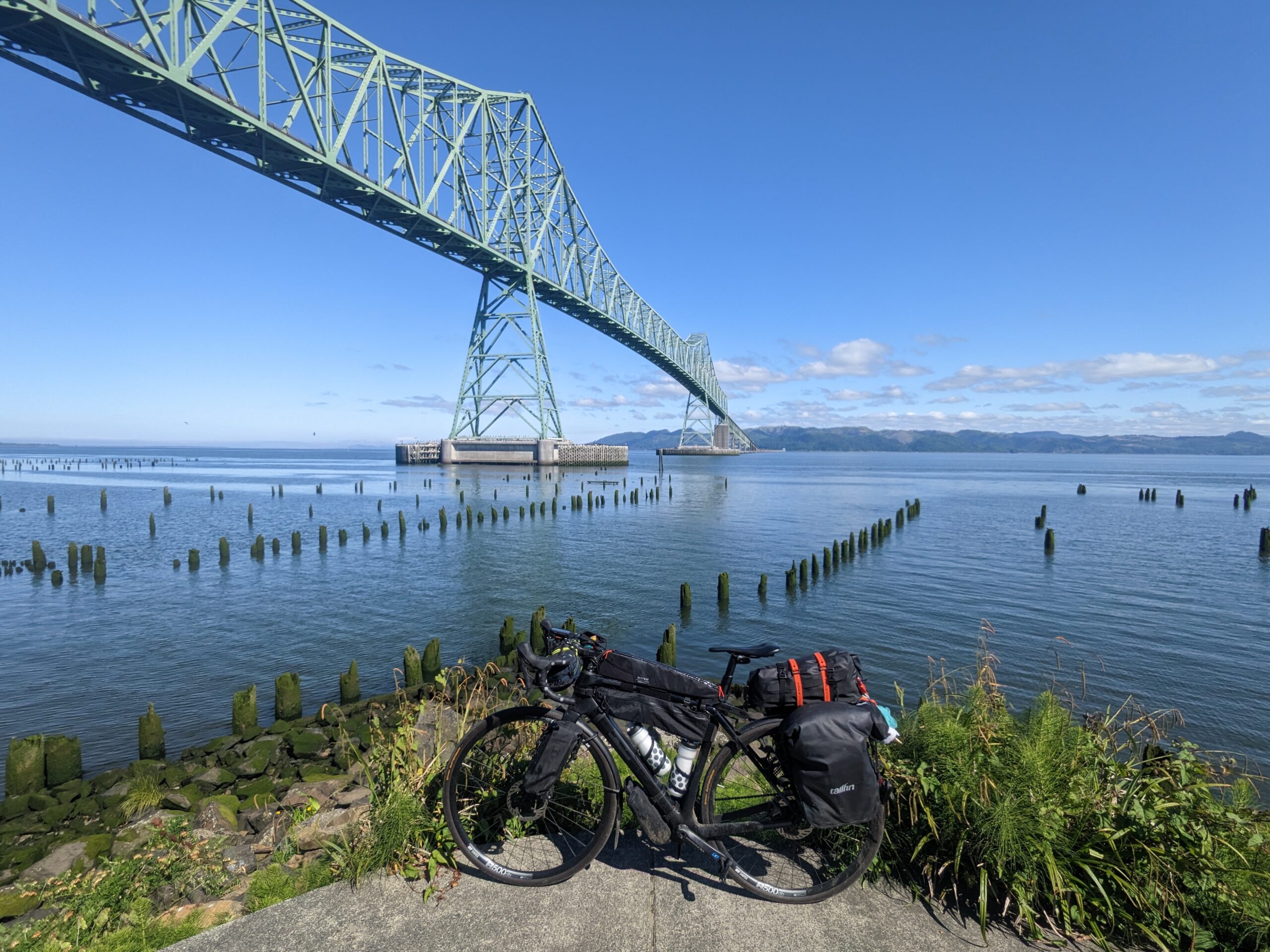
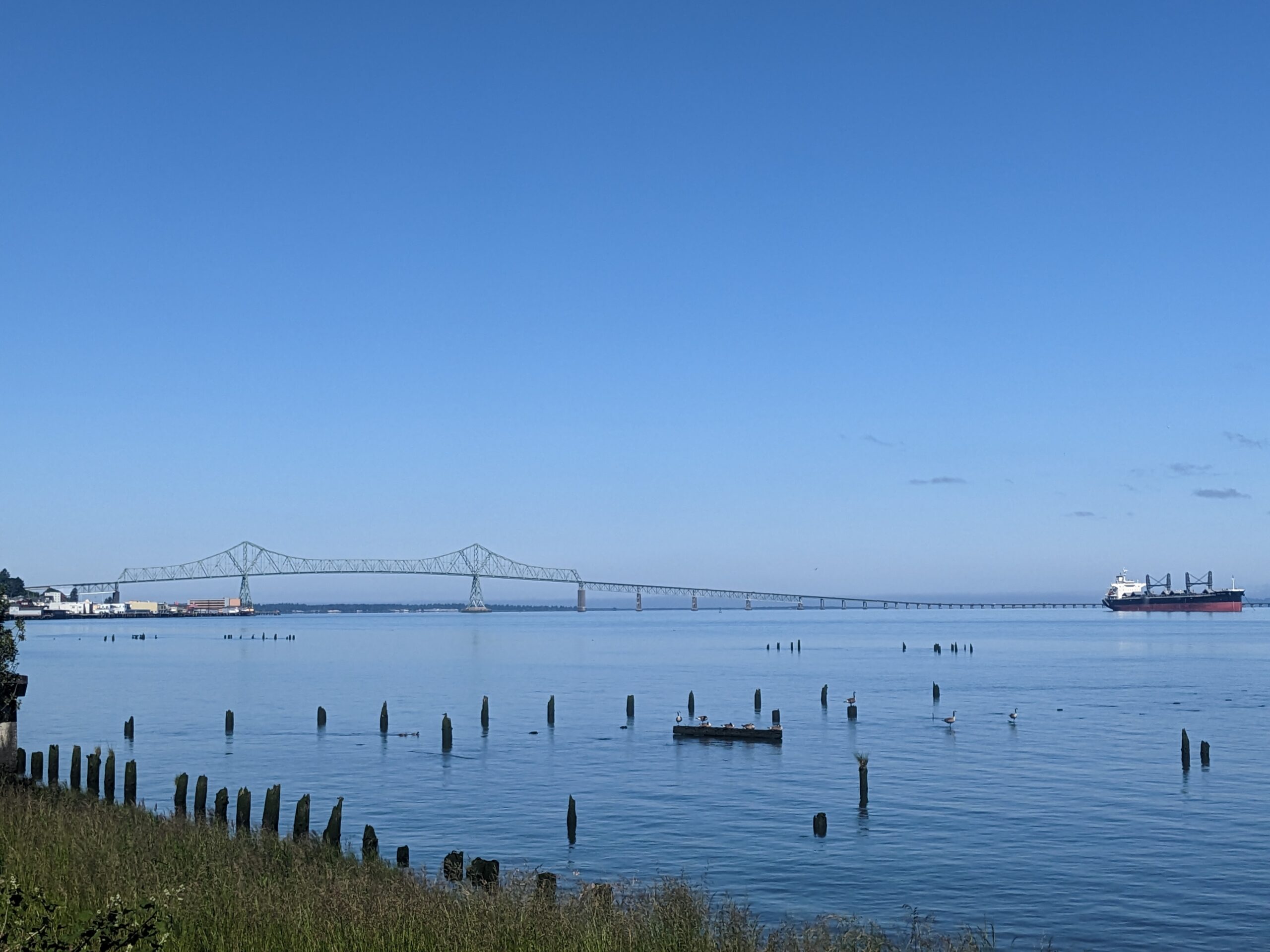
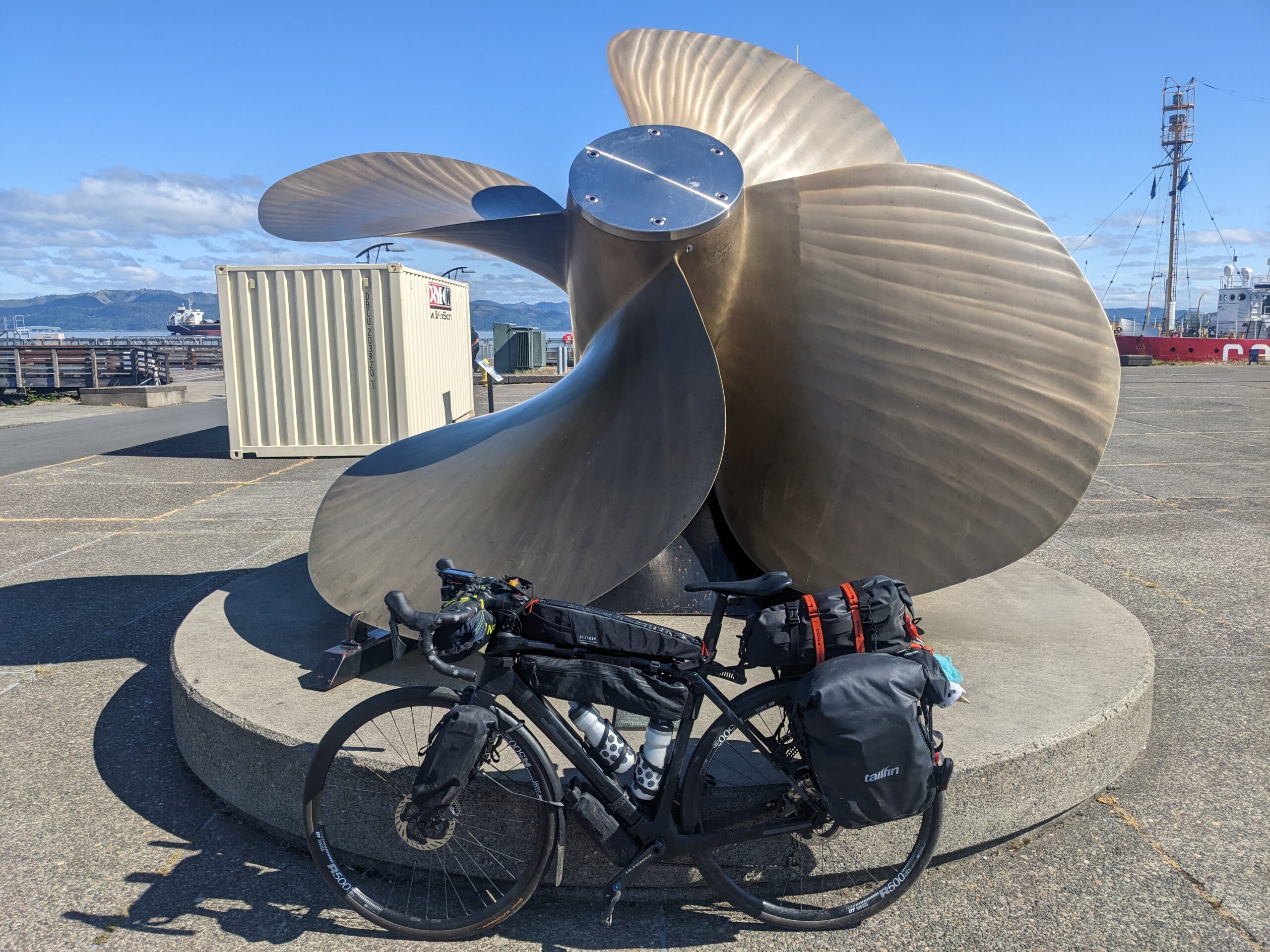
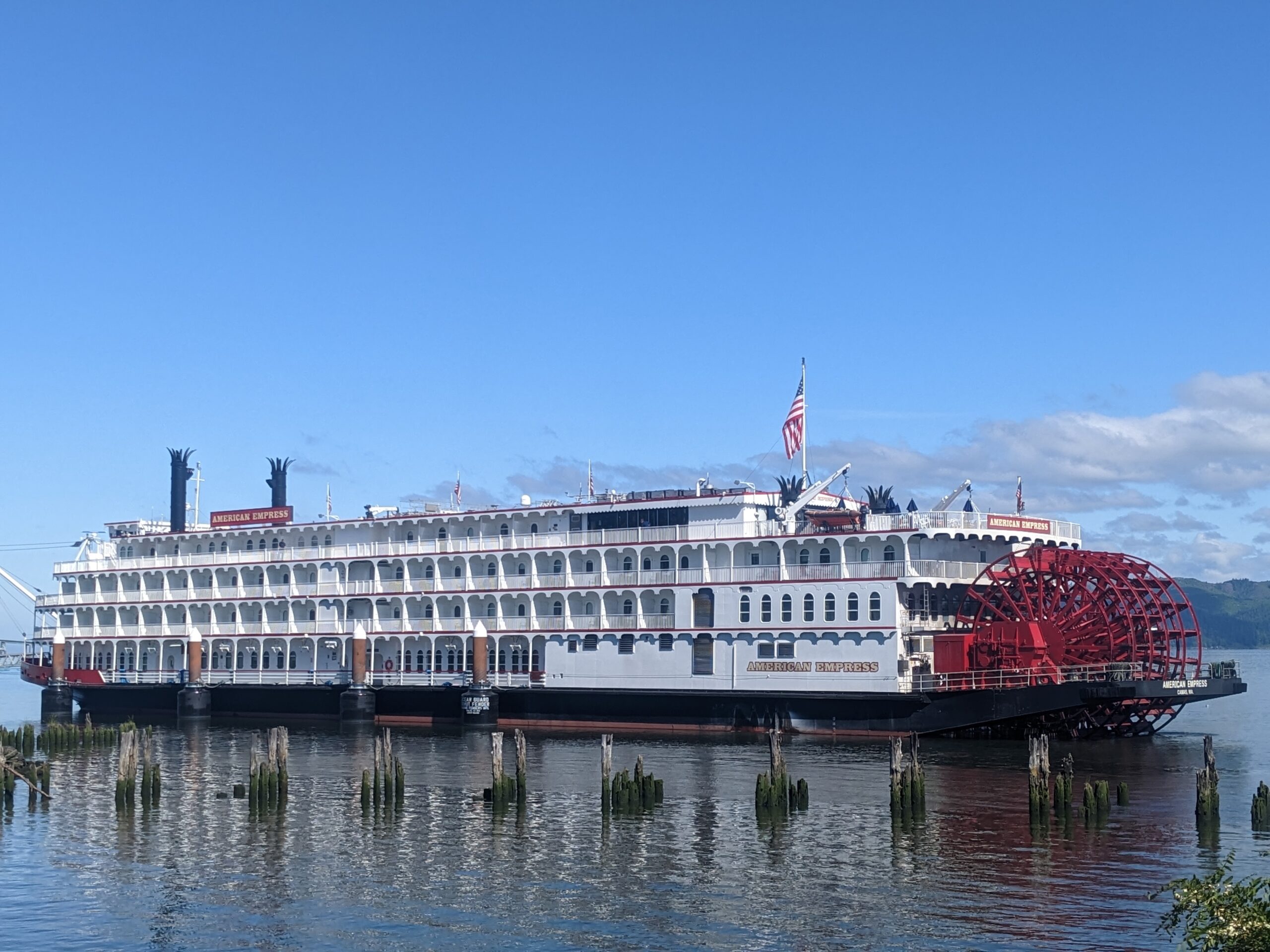
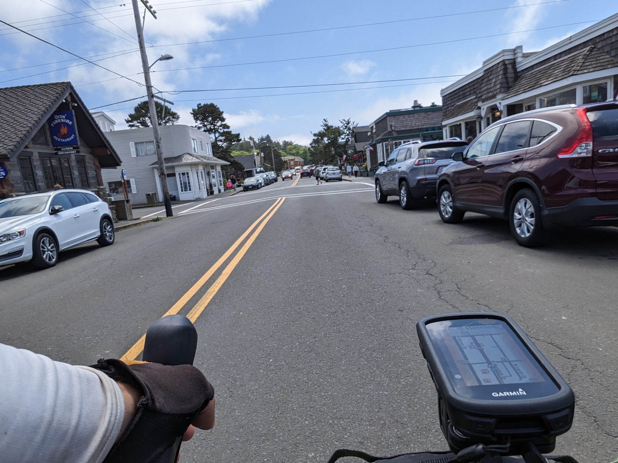
Astoria was gorgeous. Quaint oceanside town with all the touristy things going on. I stuck to the coast for much of the route, but still got to see some cool stuff. The coolest would be the Columbia River Maritime Museum. They had all sorts of nautical items spread out and around their campus including the huge prop that I snapped a picture of. Also snagged a picture of the American Empress paddle boat which I’d seen sailing the Columbia River yesterday while waiting for the ferry.
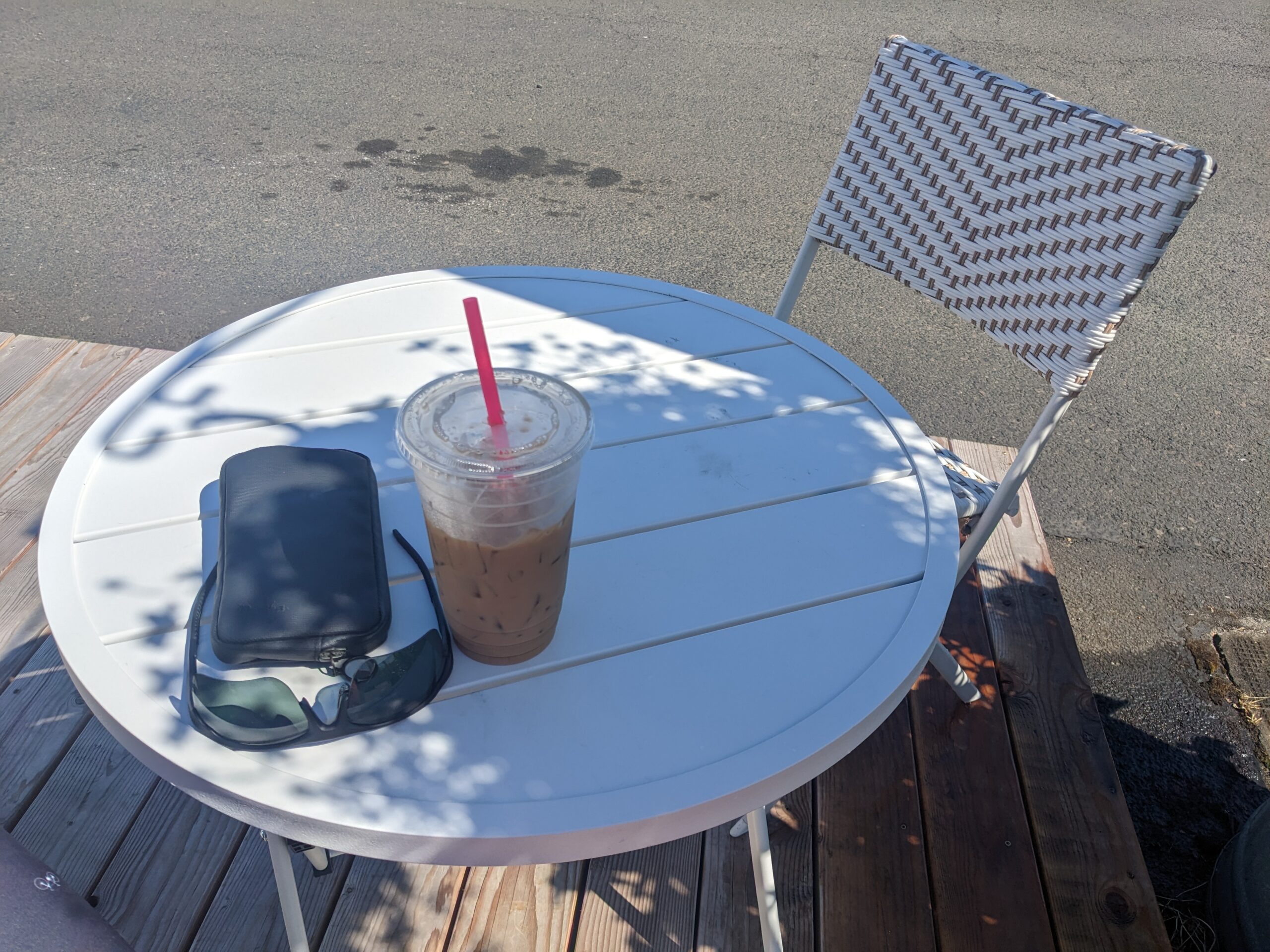
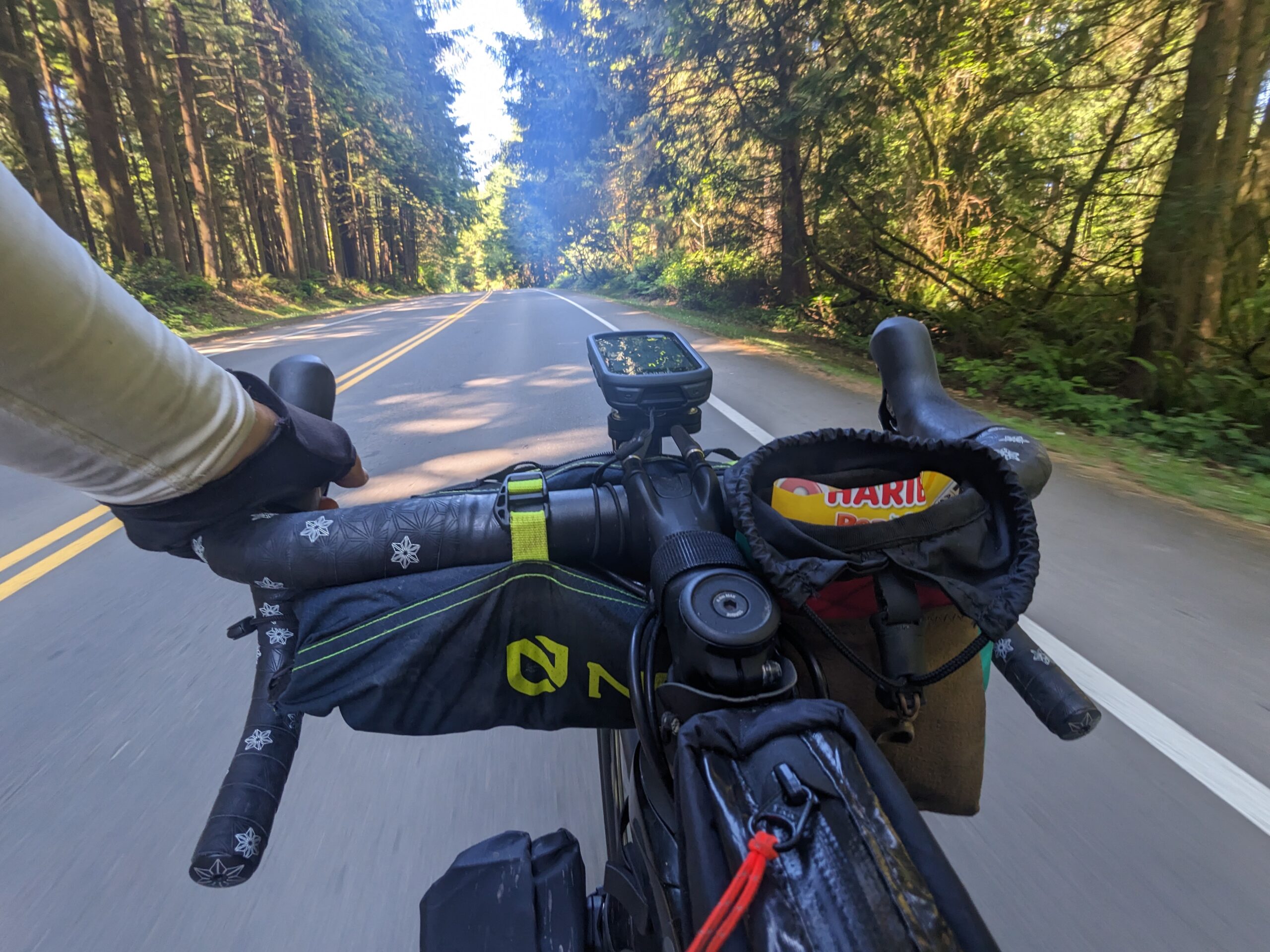
After crossing over the Youngs Bay Bridge I spotted River Brew Coffee, one of those cute little coffee stands, and thought, “What the hell.”. I pulled a quick U-turn and ordered a cold brew. They also had a bowl out with some Tootsie Pops with a sign that read, “Take one or two.” So I snagged one and threw it in my frame bag for later. The guy running the joint offered me a chair to relax in while enjoying my coffee break. We even talked about how the drag he was located on was popular with the local cycling scene. I shouldn’t have been surprised when I spotted a pair of cyclists riding in the opposite direction while I drank.
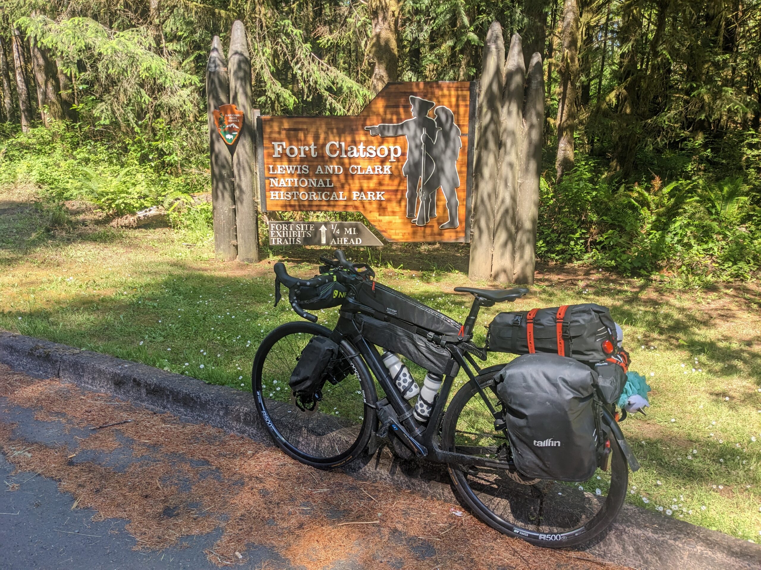
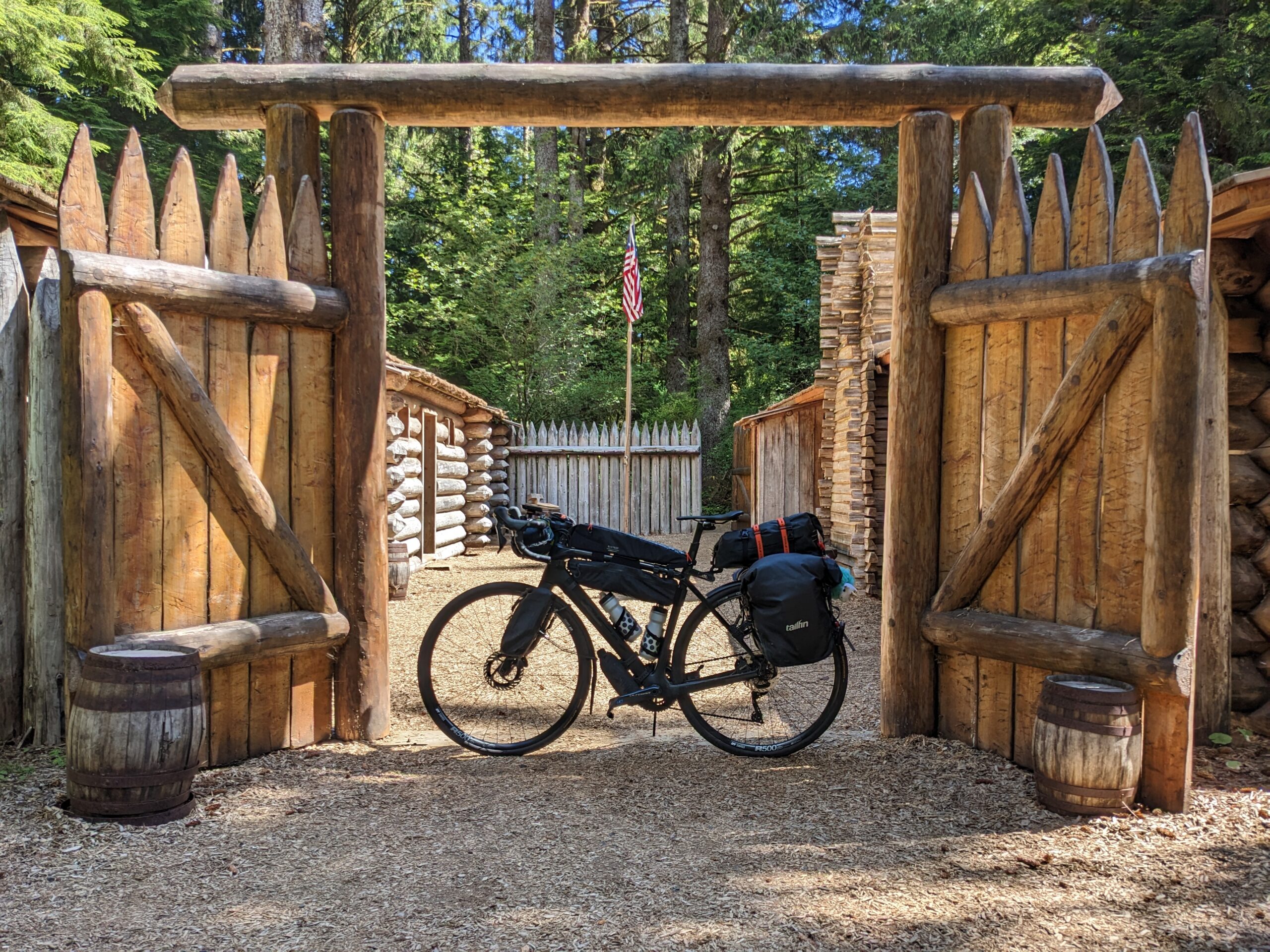
With my caffeine fix satisfied, I found myself on this beautiful roadway. It was so smooth and dead quiet. Then I saw a sign for Lewis and Clark National Park and knew that was the reason why. I saw another sign for Fort Clatsop and figured, again, “What the hell” and made the turn. I checked in at the portable to ask about riding my bike on the trails, not allowed, and to see what was open. I was told I could walk to the replica fort,the visitor’s center and bookstore, and any trail I wanted. I decided on the replica fort and bookstore and was glad I did. Had a good experience and got a couple good pictures as well.
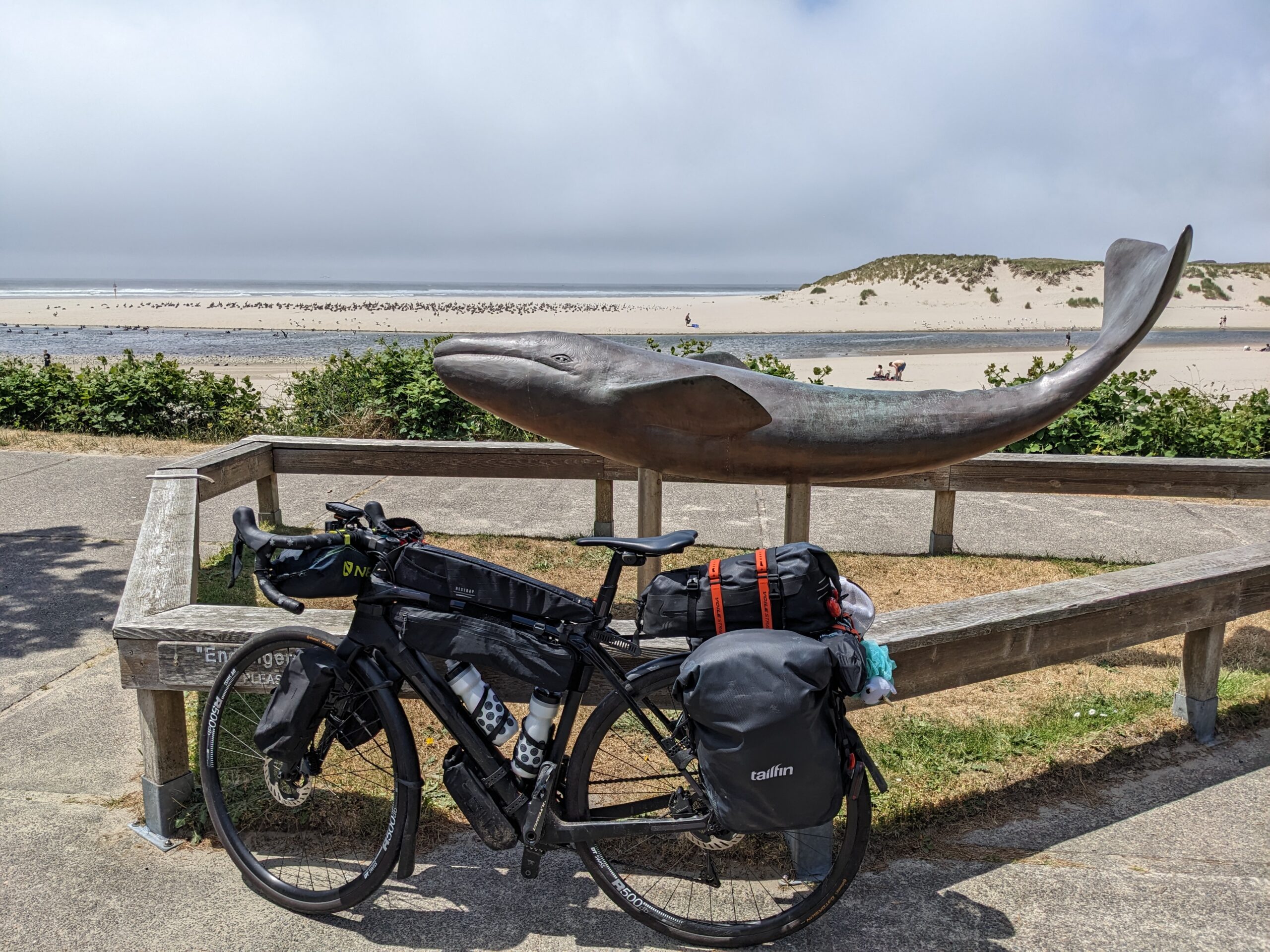
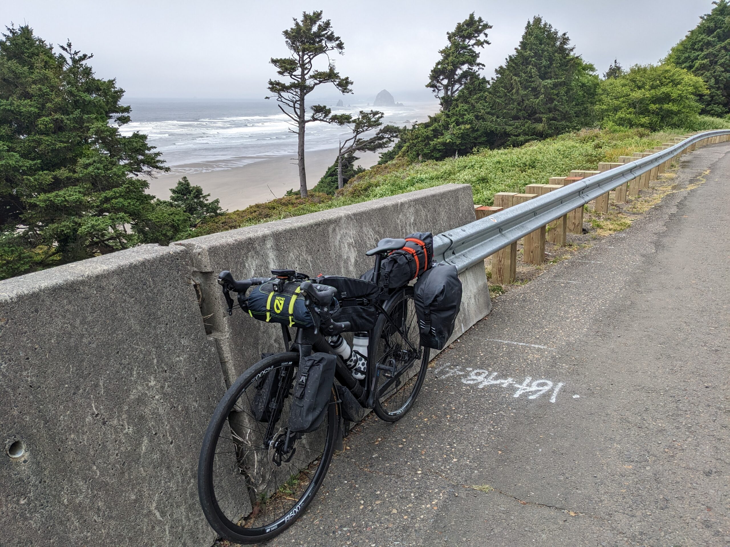
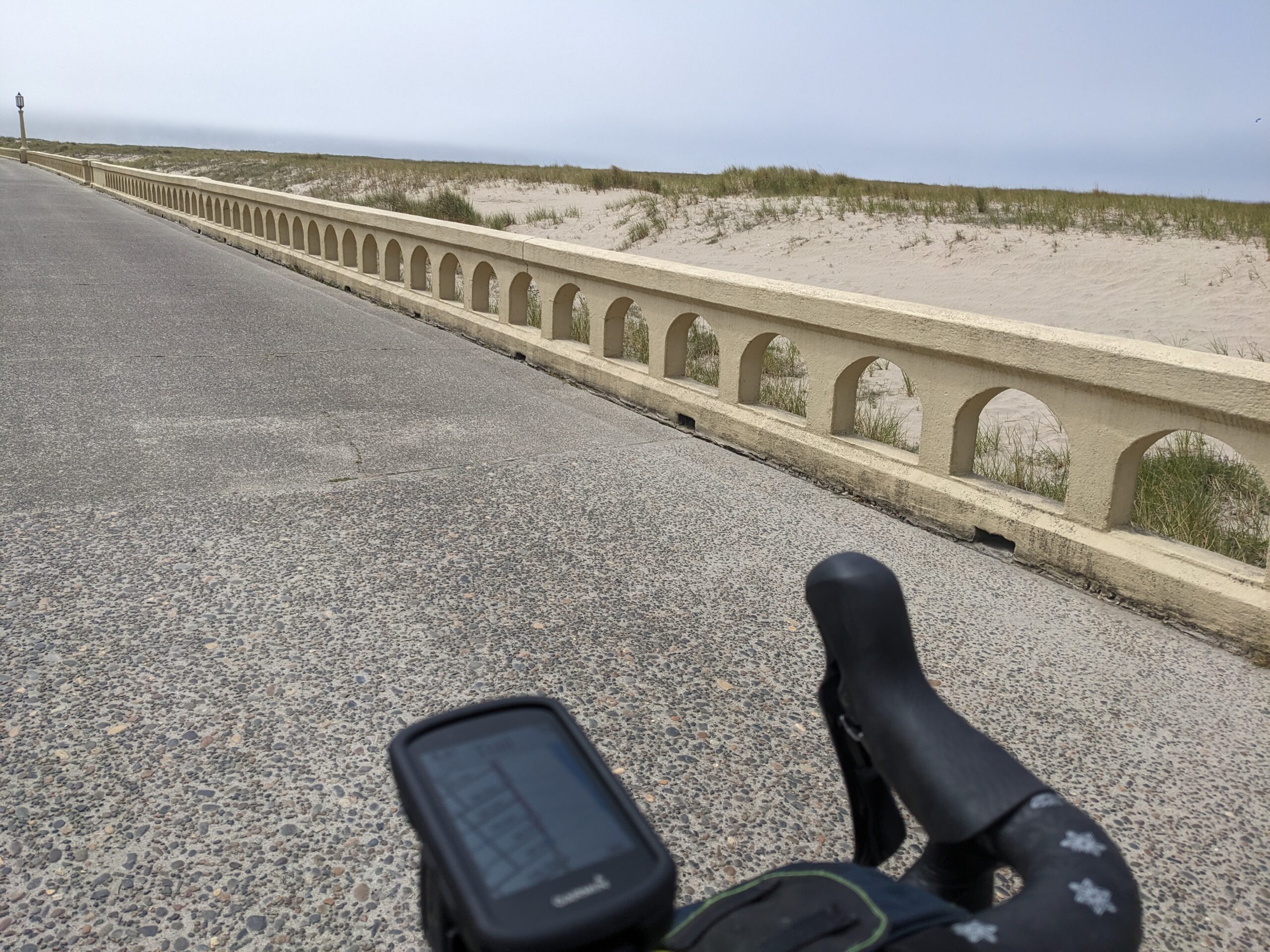
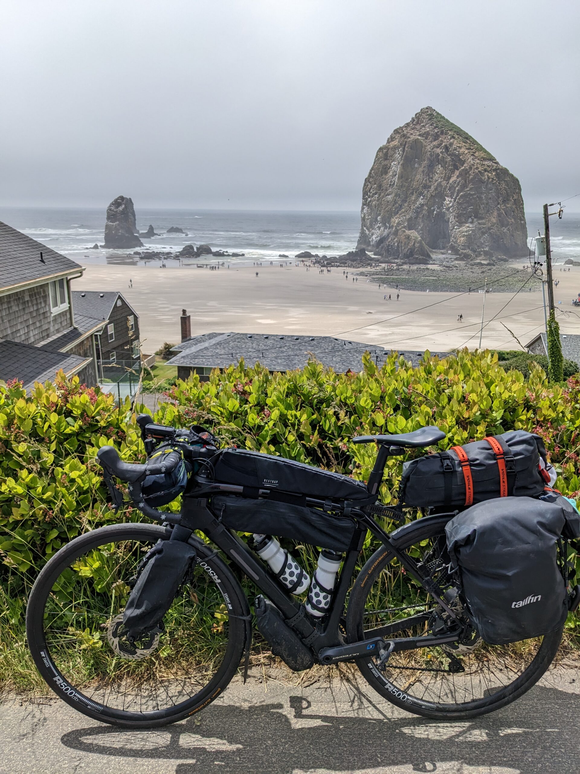
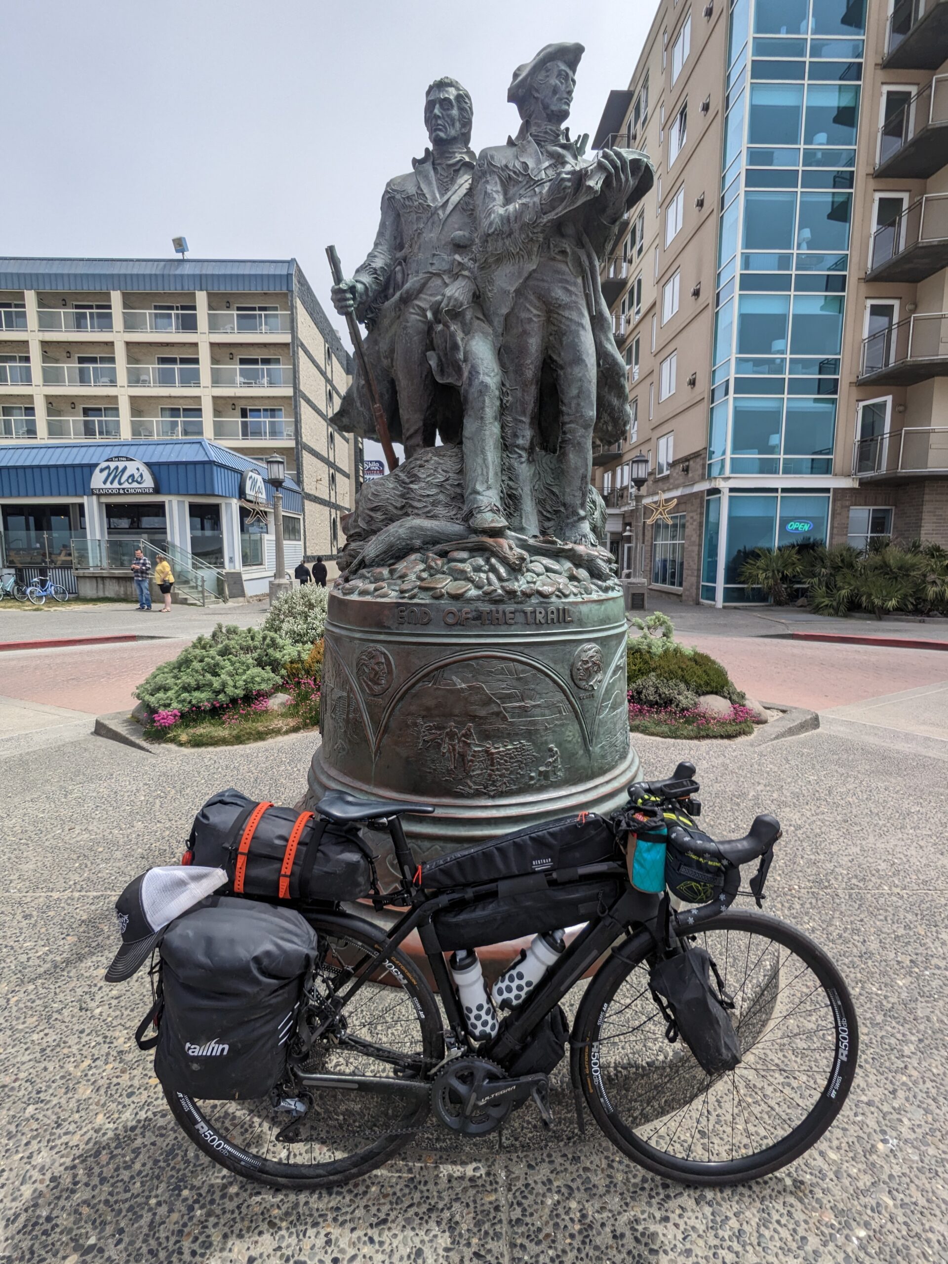
After the fort, it was a nice back country road until dropped into Seaside. I worked my way through town until I was riding on the oceanside promenade. Sadly, the marine layer had rolled in turning the sky flat grey. I did get a cool picture of a Lewis and Clark statue depicting the “End of the Trail”. End of the trail for them, but still many more miles for me.
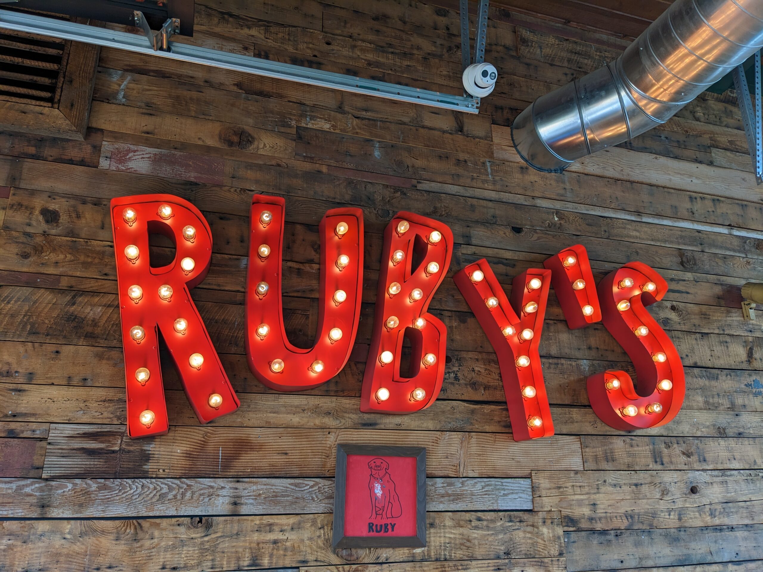
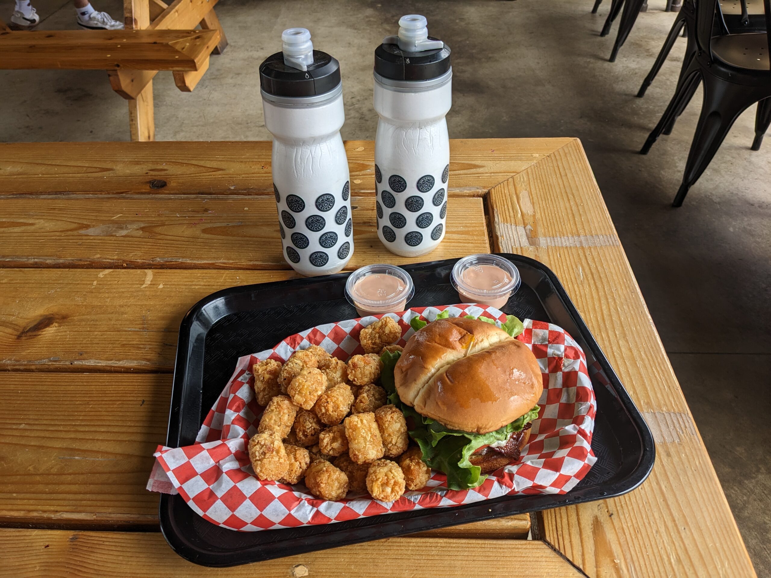
It was just past one and I was on the lookout for something to eat. I passed a couple local eateries, but they didn’t look very accessible for Shadow and I. When I came to a red light at US-101 I saw Ruby’s Roadside Grill across the street and thought, “Bingo!”
I stared at the menu before finally deciding on the Bleu Cheese & Bacon described as melted bleu cheese crumbles, bacon, lettuce, tomato & creamy bleu cheese dressing. With a choice of potatoes I went with tater tots, naturally. Once I finished ordering I asked if I could make use of an outlet. They obliged me and I set my phone and power bank to charging while I ate. The burger and tots were both awesome. The blue cheese had just enough bite, but not over blown. The tots had the perfect amount of crunch on the outside and soft in the middle. Add to that the fry sauce and I was golden.
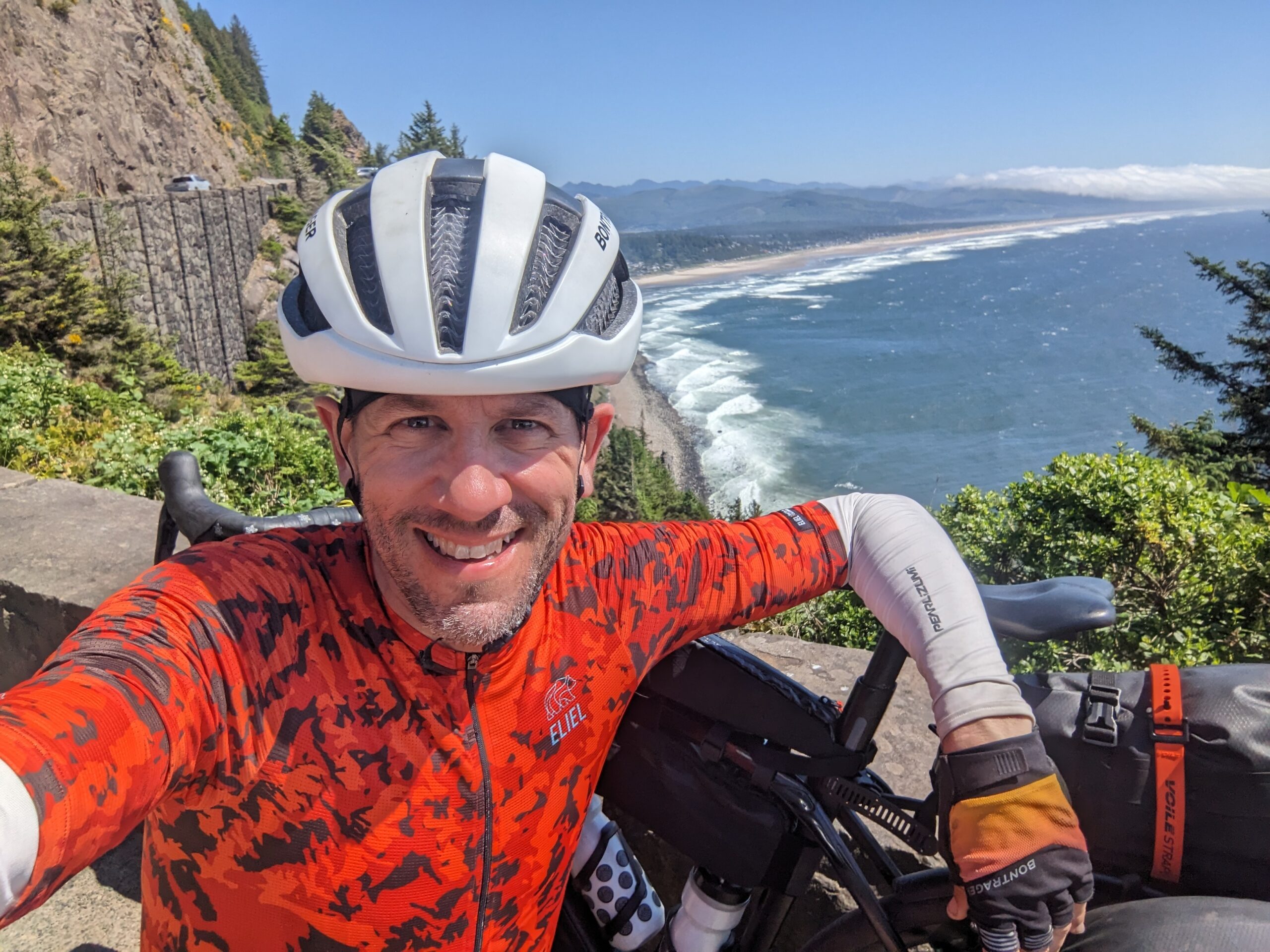
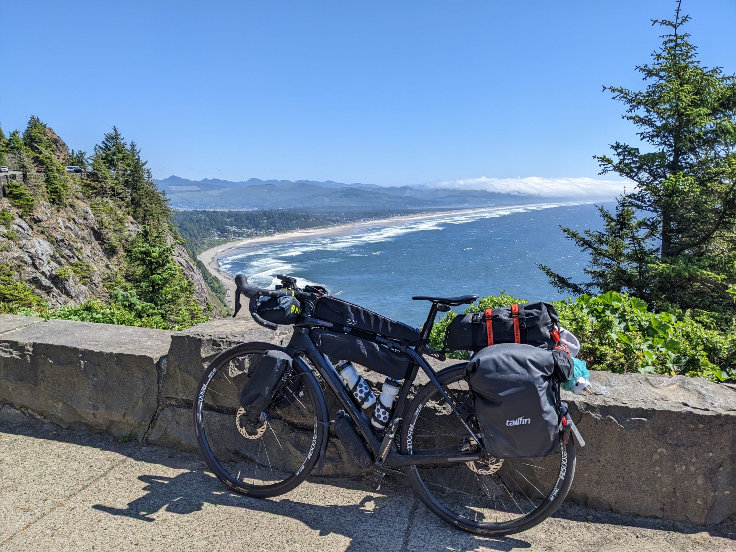
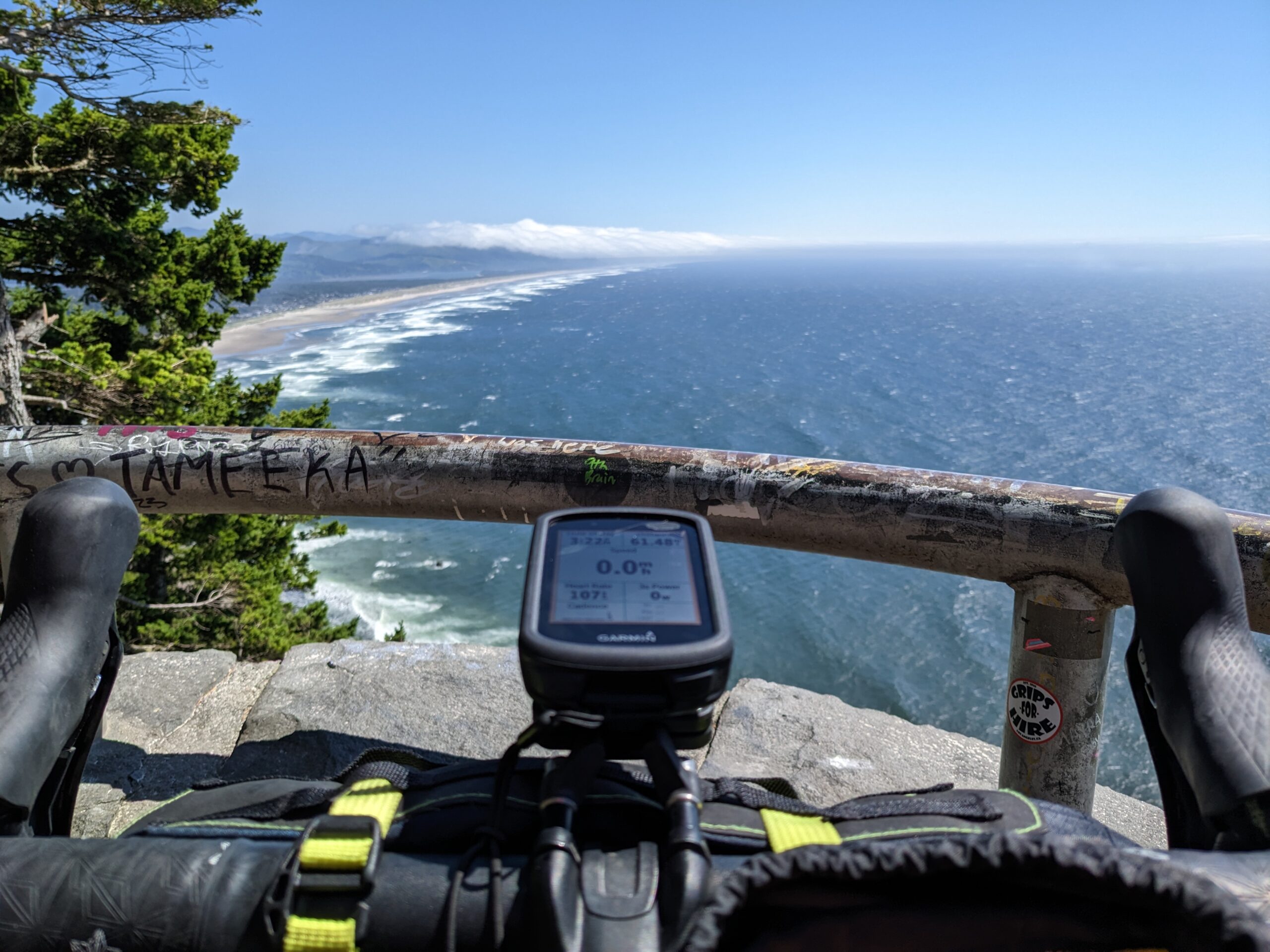
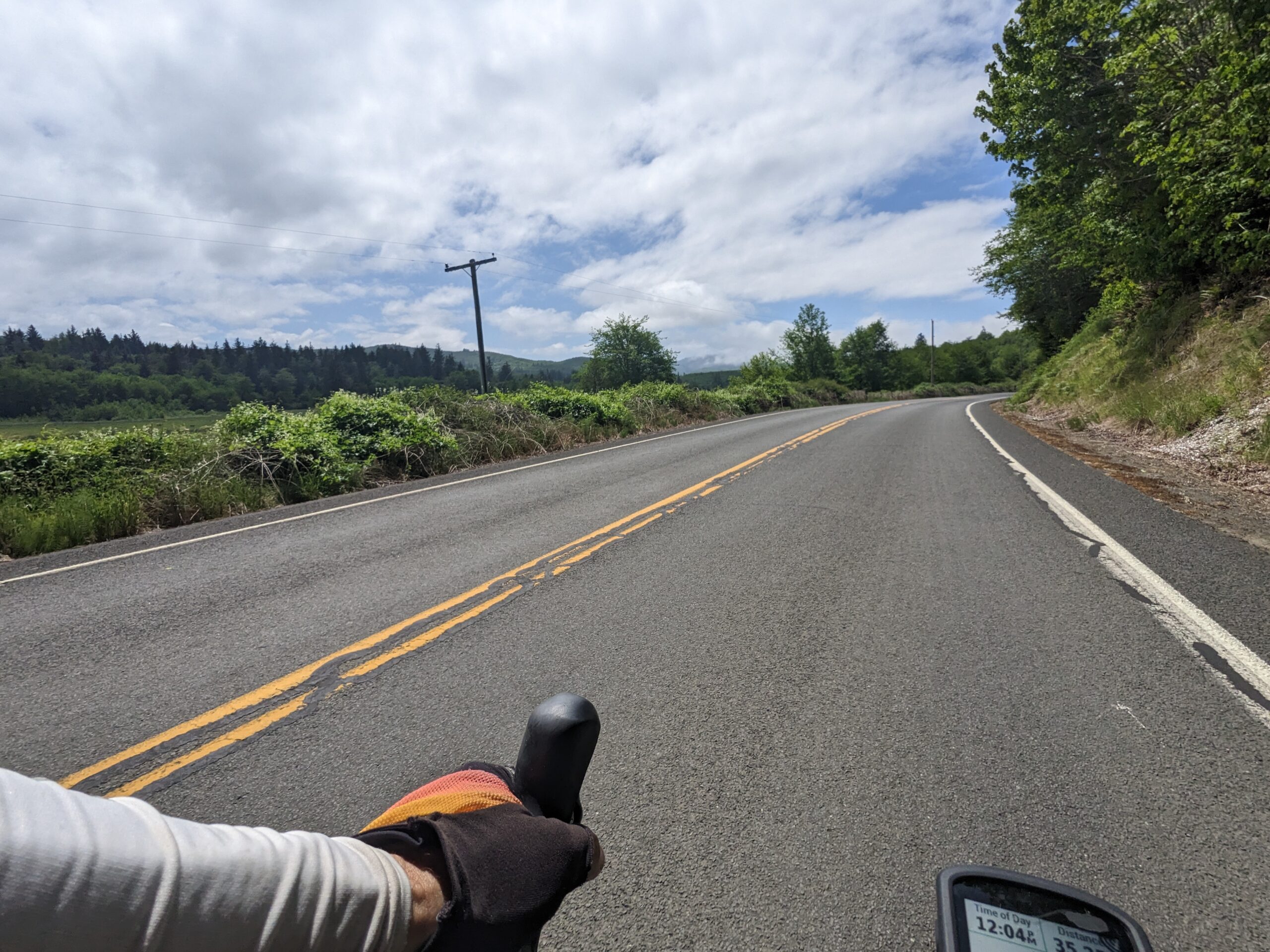
With lunch out of the way it was straight on until camp. Rolling out of Seaside I was freezing. The marine layer had thickened up and I was getting a decent tailwind so I was barely working. I seriously considered getting my puffy jacket out, but decided against it. Thankfully it didn’t take long before a steady climb came up and I got all the warmth I needed. Snagged a couple pictures at the different lookouts along the way. Pretty happy with the way they turned out.
Once I arrived at camp I approached the gate and one of the rangers motioned me up. He asked, “You planning on staying with us tonight?”
“Yes, sir. Got any hike/bike sites still available?” I replied.
While showing me the campground layout on a map he says, “Oh yeah. So the hike/bike sites are right through those trees. There are lockers available with USB ports to charge your devices. Walk along this trail here to get to the bathrooms. You continue along this trail to more bathrooms and the free showers. That’ll be $8.”
I was flabbergasted. This has been the cheapest campsite yet, but has had the most features hands down. I ask him about getting some food and he gives me some pretty easy directions. “As you leave the park, take a left. When you come to the next road you’ll see a bike path, just follow it all the way around until a stop. Take a right and look for the apple store. They have good sandwiches and other food.”
Thanking him I set out for town to grab something for dinner before setting up camp. He was right, nice dedicated bike lane all the way back into the heart of town. Awesome. I’m slowly cruising down what feels like main street Manzanita when I spot a store sign that reads “Manzanita Market The Little Apple” and I know I must be at the right place. I park Shadow and head inside.
I ask the folks working the front counter, “I’m told y’all got good sandwiches here?” and the point me to the deli counter. Presented with a large array of choices I got one of the sandwiches already made. While I’m waiting on the deli girl to cut my sandwich in half, a local walks up and says, “That’s a pretty nice bike of yours out there.”
I respond, “When you say it like that you make me nervous!”
She tells me that she meant it was literally a nice bike with how it’s all done up. Her husband chimes in with his accent. Then, naturally, the questions come out and I explain the whole thing before finally grabbing my sandwich and a few other essentials for the evening and check out.
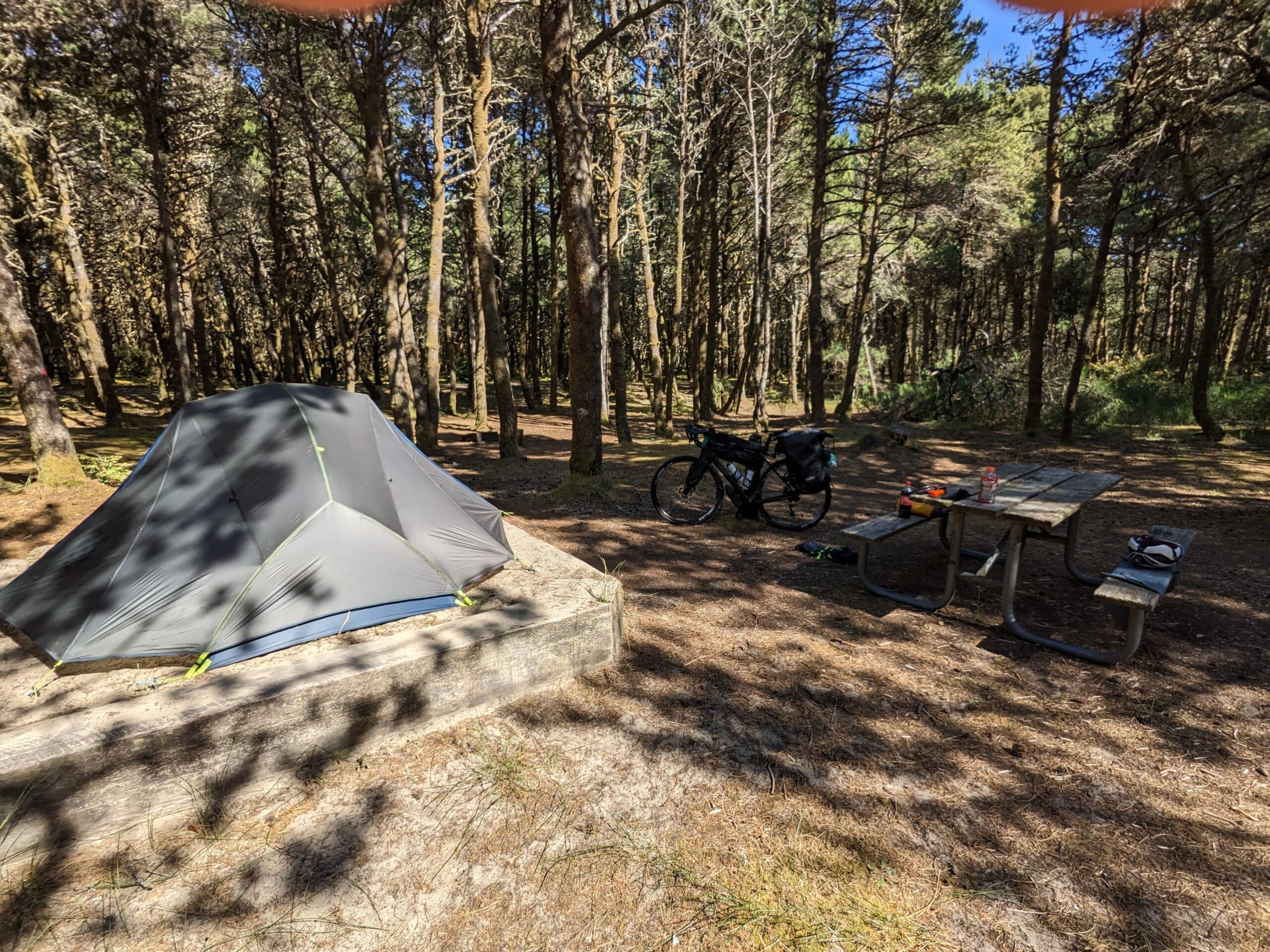
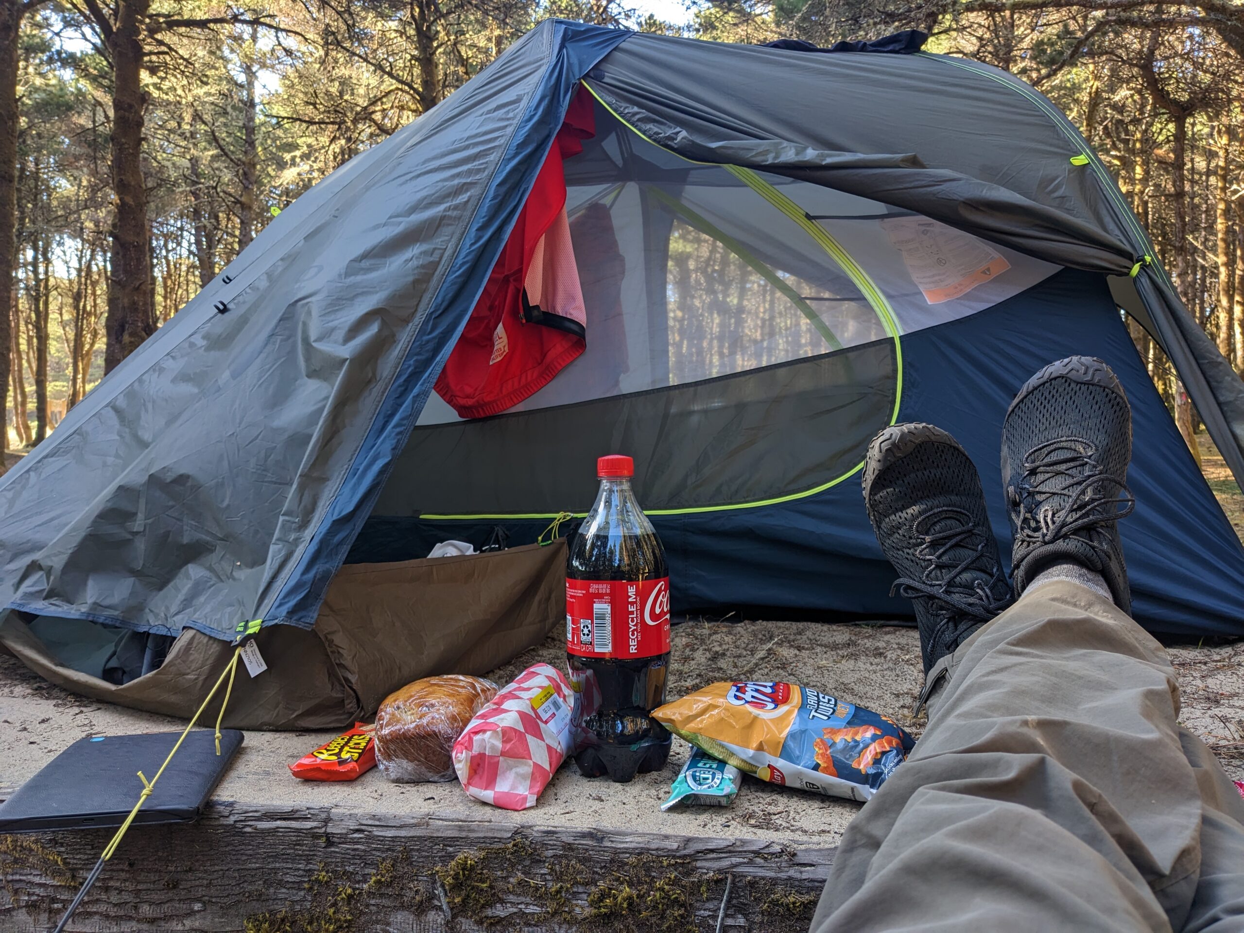
When I get back to camp, I roll into the hike/bike area and I’m surprised once again. Each site, about a half dozen or so, has a raised sandbox for pitching your tent! How awesome! No having to worry about a sharp rock trashing the floor of your tent or sleeping pad. I’m telling you I think this place is bikepackers nirvana! I get camp all setup and get everything to charging while I go wash BOTH sets of kit. As I’m sitting here I seriously hope they dry before morning, but I’m not going to hold my breath.
As I’m getting camp organizer a couple roll up on their bike all loaded with gear. They pick out a site a few away from me and get started with their own setup. I holler over, “Pacific Coast?”. The guy replies, “Yup!”. So first cyclists I’ve come across who are riding as far as I am. Then a short while later a solo female rider rolls in and starts setting up her camp.
One downside to the park’s USB lockers is they’re all USB-A and my power bank and phone are both USB-C. I also only brought USB-C to USB-C cables for both devices. I set out in search of a wall outlet and found one in the nearest men’s bathroom.
I brought my camp chair over and decided to hang out outside the bathroom while my power bank charged and wrote all this. While I was sitting there the solo female cyclist, Robin, walked up and asked where I was headed. This sparked a close to hour long, if not longer, conversation about my trip, my previous attempt, her multiple tours, and the list goes on. Most importantly she told me that when I go south I can do the Three Capes Scenic Drive.
The Three Capes Scenic Drive is hailed as one of the most scenic drives in Oregon. A few years back a landslide made the road impassible for cars. A handful of cyclists still ride through and enjoy beautiful scenery with no traffic. I’d thought of backtracking in order to see parts of this loop, but Robin assured me that you can ride straight on through and that she’d just done it today. So my plans for tomorrow are to do the loop which will end right where I would have started backtracking. Score!
I think that about sums up today’s events and ride. Overall, it was a good ride despite the crappy cold section in and around Seaside. To the north and south of there was bright blue warm sunny skies. Here’s hoping for more of those tomorrow!
New bike fund: $5.08 (+$0.08)
65.55 new miles — From Wandrer.earth
Mostly cloudy-Sunny, 57°F-63°F, Feels like 62°F-69°F, Humidity 89%-76%, Wind N 2mph-NW 6mph – by Klimat.app
— myWindsock Report —
Weather Impact: -7.9%
Headwind: 21% @ 3.5-8.1mph
Longest Headwind: 41m 26s
Air Speed: 11.4mph
Temp: 60.2-68.7°F
Precip: 0% @ 0 Inch/hr
— END —


Max elevation: 623 ft
Min elevation: 21 ft
Total climbing: 4307 ft
Total descent: -4427 ft
Total time: 08:00:18
Be First to Comment